Site Location: Lat.: 68° – 21’ – 42” N.; Long.: 133° – 43’ – 50” W. (GPS: 68.361667, -133.730556). At the north end of the Dempster Highway, km 736 (mi. 457).
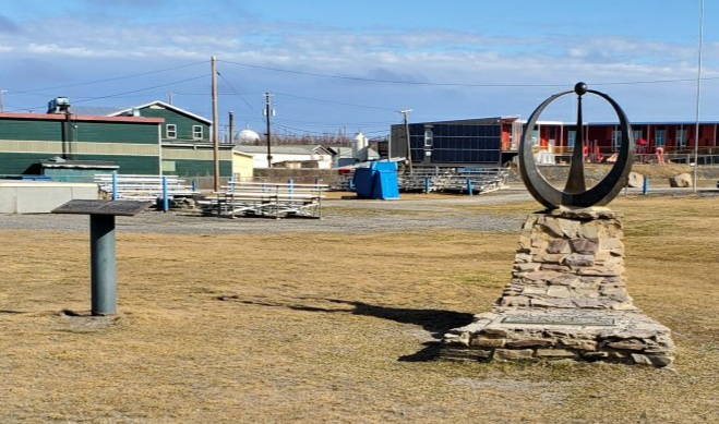
Plaque Location: The plaque is mounted on a pipe column in Chief Jim Koe Park, Inuvik. (GPS: 68.3564889, -133.7199569). From the Dempster Highway, turn left (west) onto MacKenzie Road and proceed 1.3 km to Chief Jim Koe Part on the left (north).

Description: The town of Inuvik was built to replace the flood-prone community of Aklavik, which had served as a key centre for trade and transportation for the Mackenzie Delta since 1920. An extensive selection process in the 1950s throughout the Delta area ultimately identified the site for the new town, some 2,000 km (1250 mi.) northwest of Edmonton. The design and construction occurred in the late 1950s and early 1960s.
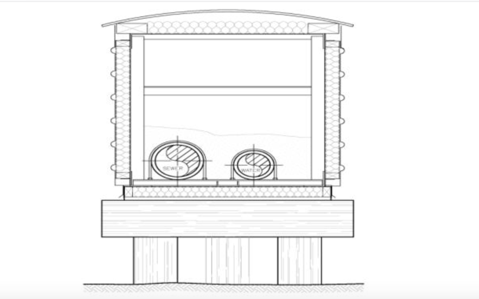
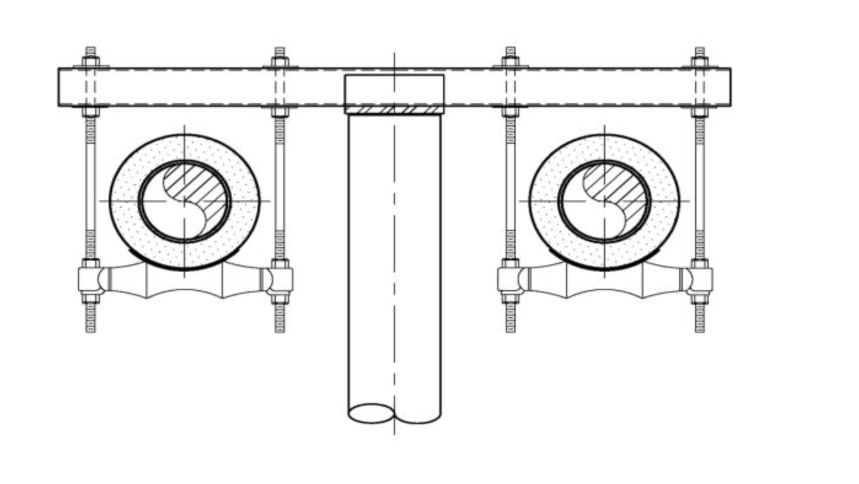
Inuvik is situated on permafrost. To prevent heat from warm buildings and services thawing the permafrost, causing them to sink, most structures are constructed on timber piles drilled five metres into the ground. A space of one-half to one metre is maintained between the ground and the soffit of the structure. Water and sewer services are provided using heated above-ground “utilidors”, which were replaced in 2009.

(Source: K. Johnson)

(Source: K. Johnson)
Historic Significance: Inuvik is Canada’s largest, and the first completely “engineered”, community north of the Arctic Circle. The design and construction of Inuvik pioneered cold region engineering practices such as pile construction, freeze protection of water and sewer systems and construction techniques associated with isolated northern communities. Engineers and contractors expected the permafrost depth to be one metre (3.3 ft.), but discovered instead that the permafrost depth is 350 m (1150 ft.). Inuvik’s above-ground “utilidor” is unique in the world.

Plaque Wording: National Historic Civil Engineering Site. CSCE. TOWN OF INUVIK NORTHWEST TERRITORIES. A tribute to the engineers and contractors who planned, designed and built the Town of Inuvik, Northwest Territories in the late 1950’s. Inuvik is Canada’s largest community north of the Arctic Circle. The building of Inuvik pioneered cold regions engineering design and construction practices for building infrastructure in permafrost, freeze protection of water and sewer systems in extremely cold temperatures and construction planning and execution in isolated northern communities. Inuvik’s above ground, pile supported piped utilities remain a unique and robust municipal water and sewer system. Canadian Society for Civil Engineering. 2012.
SCGC. Site Historique National de Génie Civil. VILLE D’INUVIK TERRITOIRES DU NORD-OUEST. Un hommage aux ingénieurs et entrepreneurs qui ont planifié, conçu et construit la ville d’Inuvik dans les Territoires du Nord-ouest vers la fin des anées 1950. Inuvik est la plus grande communauté située au nord du cercle arctique. Sa construction a ouvert la voie dans le domaine de l’ingénierie des regions froides et des pratiques de construction de bâtiments dans le pergélisol, la protection contre le gel des systems d’eau et d’egouts dans les temperatures extrement froides ainsi que la planification et l’exécution te travaux de construction dans des communautés isolées du nord. Les installations reposant sure des pieux hors du sol d’Inuvik restent un system d’eau et d’égouts municipal unique et robuste. 2012. Société canadienne ce genie civil.
Plaque Unveiling Ceremony: The plaque was unveiled at Hanger 14, the Alberta Aviation Museum, at the 2012 Annual Conference in Edmonton.
Links to Online Documentation:
Canadian Museum of History, “Inuvik”.
Ken Johnson, “Utilidor Replacement in Inuvik, NWT”, 2010 WCW Conference Paper
Samantha Stokell, “Inuvik nominated for national award”, Northern News Services, 2011.