
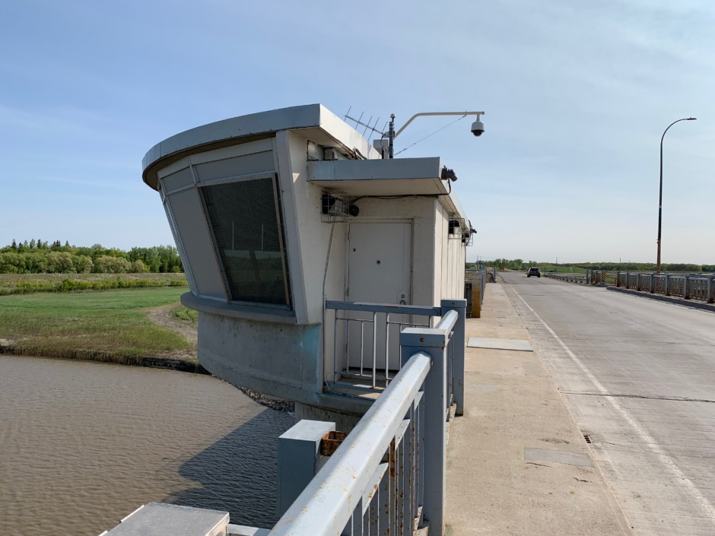
Site Location: Inlet Control Structure: Lat.: 49° – 45’ – 3” N; Long. 97° – 8’ – 1” W. (GPS: 49.750931, -97.133710). From Perimeter Highway/Trans-Canada Highway 100 take Lord Selkirk Highway/Pembina Highway/ PTH-75 S. After 2.7 km, turn left (east) onto Turnbull Drive, which soon turns to the south east, and after 1 km turn left (north east) on Courchaine Road. Proceed 0.3 km to the inlet control structure.
Plaque Location: The plaque is currently mounted on an interior wall of the Flood Inlet Control Structure, and is not accessible to the general public.
Description: The great Winnipeg Flood of 1950 forced over 100,000 people to evacuate their homes. A subsequent nine-volume 1953 federal report recommended construction of several flood control measures including a 26-mile (42-km) long floodway around Winnipeg. Although the projected benefit/cost ratio was 2.73, there was concern that the project was unaffordable because the estimated cost, $72.5 M roughly equalled the annual net provincial revenue of $74. M. Duff Roblin, Leader of the Opposition, supported the project: detractors referred to it dismissively as “Duff’s Ditch”. In June 1958, Roblin was elected Premier of Manitoba and established the Red River Floodway Advisory Board.
Construction commenced in October 1962 on the Floodway, to take part of the Red River’s flow around the city of Winnipeg to the east and discharge it back into the Red River below the St. Andrews Dam at Lockport. The Inlet and Outlet Control Structures were designed by consultants H. G. Acres & Company Ltd., Niagara Falls, based on model studies conducted at the University of Manitoba. The Inlet Control Structure was built, under a joint contract, by the Northern Construction Company and J. W. Steward Limited, both of Vancouver, and Bird Construction Limited of Winnipeg. Bird Construction also built the Outlet Control Structure. The steelwork of the 320 ton sector gates and the hydraulic operating pistons were fabricated by Horton Steel Works at their Fort Erie plant. The original capacity was 2,500 m3/s (90,000 cu. ft./s). The floodway was completed on schedule in March 1968 at a cost of $62.5 M. It was expanded in the 2000s to increase its capacity to 4,000 m3/s (140,000 cu. ft./s).
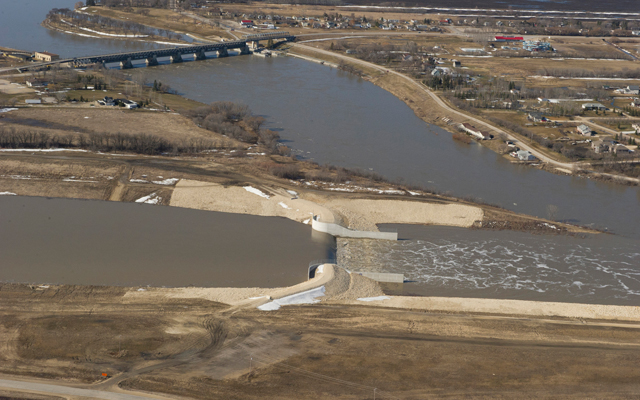
Historic Significance: At the time of construction, the Floodway was the largest excavation project ever undertaken in Canada and the second largest earth-moving project in the world. The floodway channel was designed to ensure long-term stability of the side slopes, limit the maximum water velocity to preclude bank erosion, and select the optimal channel cross-section and gradient. The Floodway has since been effective in preventing significant damage in the major floods of 1969, 1970, 1974, 1979 and the 1997 “Flood of the Century.” It has prevented more than $40 billion (2011 dollars) of flood damage in Winnipeg since 1968 – that’s a benefit/cost ratio in the hundreds.
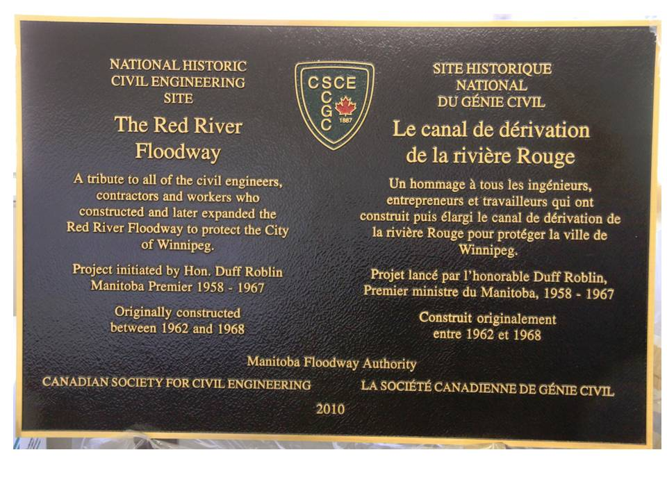
Plaque Wording: National Historic Civil Engineering Site. CSCE. THE RED RIVER FLOODWAY. A tribute to all of the civil engineers, contractors and workers who constructed and later expanded the Red River Floodway to protect the City of Winnipeg. Project initiated by Hon. Duff Roblin Manitoba Premier 1958 – 1967. Originally constructed between 1962 and 1968. Manitoba Floodway Authority. Canadian Society for Civil Engineering. 2010.
Site Historique National du génie civil. LE CANAL DE DÉRIVATION DE LA RIVIÈRE ROUGE. Un homage à tous les ingénieurs, entrepreneurs et travailleurs qui ont construit puis é largi le canal de derivation de la rivière Rouge pour protéger la ville de Winnipeg. Projet lance par l’honorable Duff Roblin, Premier minister du Manitoba, 1958 – 1967. Construit originalement entre 1962 et 1968. Manitoba Floodway Authority. La Société canadienne de genie civil. 2010.
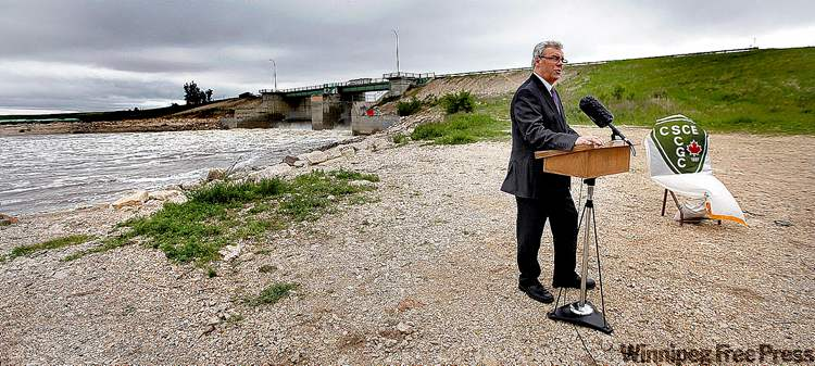
Plaque Unveiling Ceremony: The plaque was unveiled on June 11, 2010.
Links to Online Documentation:
Robert W. Passfield, "'Duff's Ditch': The Origins, Construction, and Impact of the Red River Floodway", Manitoba History, 2002
Canada’s Historic Places, “Red River Floodway National Historic Site of Canada”.
Manitoba Historical Society, “Historic Sites of Manitoba: Red River Floodway – Inlet Control Structure (Winnipeg)”.
Winnipeg Free Press, “’Duff’s Ditch’ recognized as historic site.”