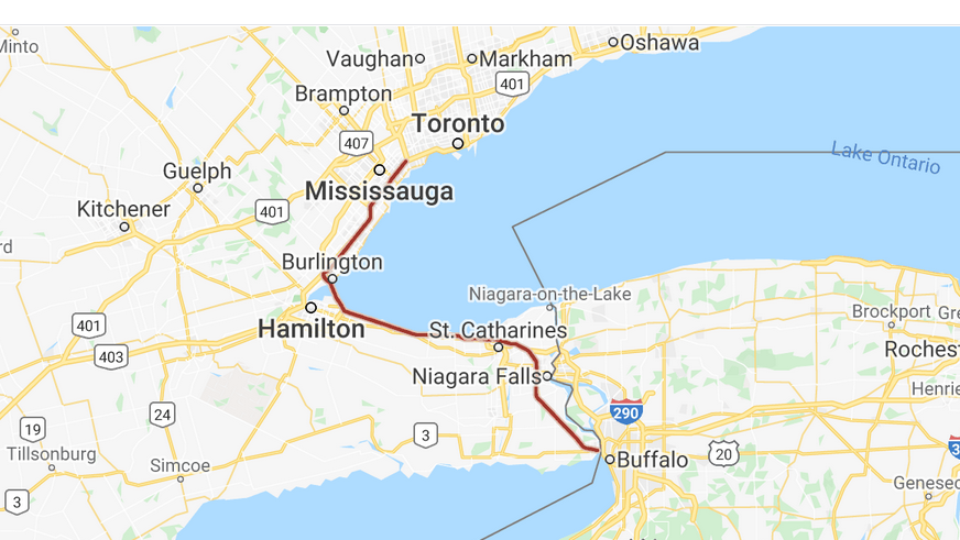
Site Location: The Queen Elizabeth Way runs between Highway 427 in Etobicoke, ON, and the Peace Bridge at Fort Erie, ON, through Mississauga, Oakville, Burlington, Hamilton, St. Catharines, and Niagara Falls.
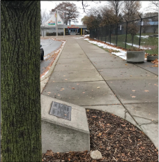
Plaque Location: The plaque is located on a plinth in Confederation Beach Park, Hamilton, adjacent to Wild Waterworks water park. Lat.: 43° – 14’ – 42” N.; Long.: 79° – 44’ – 49” W. (GPS: 43.2450413, -79.7469092). Take Exit 88 of the Queen Elizabeth Way. If southbound, take the South Service Road and turn left (north) on Highway 20/Centennial Parkway for 400m and then left( west) on Van Wagners Beach Road. If northbound, take the North Service Road to the Highway 20/Centennial Parkway intersection and continue straight on Van Wagners Beach Road. Proceed 0.5 km from the Highway 20/Centennial Parkway intersection and turn right (east) on Confederation Drive. Proceed 0.5 km on Confederation Drive, and bear right (south) to stay on Confederation Drive for an additional 900m. Turn left onto Lake Avenue N and take the first right (east) after 0.1 km. The plaque is beneath a tree on the right, immediately after the turn. Parking is available further along Lake Avenue N.
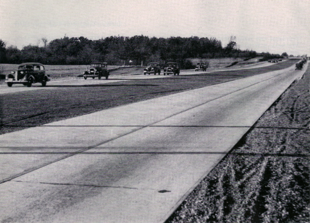
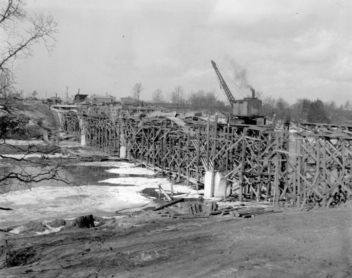
Description: The Queen Elizabeth Way is a 139 km (86 mi.) long controlled-access freeway between Etobicoke and Fort Erie, ON, around the western end of Lake Ontario. The road continues as the Gardiner Expressway to downtown Toronto. In 1931, the Ontario government initiated improvements to Lakeshore Road, Middle Road, and the Dundas Highway as relief projects during the Great Depression. In 1934, Highways Minister Thomas McQuesten and his deputy minister Robert M. Smith changed the design to resemble German autobahns, with medians dividing the opposing travel lanes and overpasses instead of traffic lights at major cross roads. The project design and construction was carried out and managed by the Department of Highways of Ontario. It was not a true freeway when it opened, first carrying traffic in 1937 and officially in dedicated in 1939, but evolved through incremental improvements to its current form by 1975.
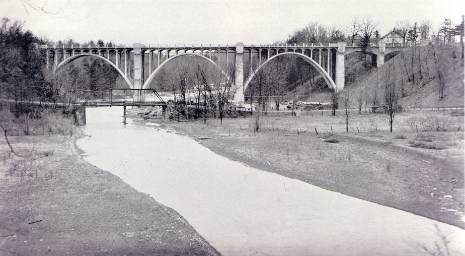
Historic Significance: The Queen Elizabeth Way is named for the wife of King George VI and mother of Queen Elizabeth II. The royal couple visited Canada in 1939 to encourage support for the United Kingdom in its anticipated hostilities with Nazi Germany, and the highway received its name to commemorate their visit. The visit was also celebrated by monuments at Henley Bridge in St. Catharines and in the highway median just west of the Humber River in Toronto, which was relocated in 1975 to Sir Casimir Gzowski Park on Lake Ontario nearby.
The Queen Elizabeth Way was the first divided intercity highway in North America. When it opened, it had the longest stretch of continuous illumination in the world. The interchange at Highway 10 (Hurontario Street) was the first cloverleaf in Canada, although many of the other intersections were roundabouts.
The highway remains the central road transportation artery of the Golden Horseshoe and has contributed greatly to the commercial, industrial and residential development of this region. During the Second World War, it predominantly carried traffic to support the war effort. Today, it is one of Ontario’s busiest highways, carrying commuters, tourists, and trade.
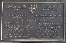
Plaque Wording: National Historic Civil Engineering Site. CSCE. Canada’s first freeway. QUEEN ELIZABETH WAY. Officially opened in 1939. A tribute to the engineers who designed and supervised the construction of this freeway. Canadian Society for Civil Engineering. 1990.
SCGC. Site Historique National de Génie Civil. La première autoroute du Canada. QUEEN ELIZABETH WAY. Inaugurée en 1939. Un hommage aux ingénieurs qui ont conçu, et dirigé la construction de cette autoroute. Société canadienne de genie civil. 1990.
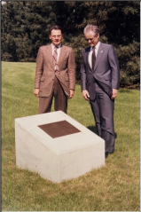
Plaque Unveiling Ceremony:
Links to Online Documentation:
History of the Queen Elizabeth Way
Photographic History of the Queen Elizabeth Way