Lachine Canal, Montreal, PQ.
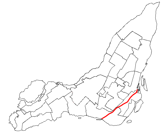
Site Location: Lat.: 45° – 25’ – 52” N; Long.: 73° – 40’ – 5” W. (GPS: 45.431047, -73.667974). From Autoroute du Souvenir/QC-20, take the QC-138 W exit south toward Pont H-Mercier. After 1.3 km, take the Rue Clément exit, Exit 2, toward Rue St.-Patrick. After 0.4 km turn right (west) onto Rue Clément and follow it for 2.0 km as its name changes to Rue Saint-Patrick and then Chemin du Canal. Turn right (north) onto Chemin Des Iroquois and continue west for 1.3 km. The Visitors Centre is on your right.
Plaque Location: The plaque is mounted on a wall on the ground floor of the Visitors Centre at Lock No. 5, Lachine Canal National Historic Site

Description: The 13.5-km.-long Lachine Canal bypasses the Lachine Rapids of the St. Lawrence River. In 1689, François Dollier de Casson, Superior of the Sulpician Order at the Séminaire de Saint-Sulpice de Montréal, initiated the first attempt to build a canal but this was abandoned in 1700. Work on the canal commenced again on July 17, 1821 under Chief Engineer Thomas Burnett and Construction Engineer John Richardson. The canal opened in 1825 with seven locks, each 30 m long, 6 m wide and 1.5 m deep was opened in 1825. The first enlargements took place between 1843 and 1848, under the supervision of engineer Alfred Barrett. Five new locks, each 61 m long, 13.5 m wide and 2.7 m deep replaced the original seven locks. A second enlargement of the canal took place between 1873 and 1885 at which time the locks were lengthened to 82 m and deepened to 4.3 m. The canal continued to operate successfully until around 1950, but became obsolete in the second half of the 20th century, being replaced by the opening of the St. Lawrence Seaway in 1959 and was finally closed to shipping in 1970. Following extensive refurbishment, the canal was reopened in 2002 as a recreational resource.

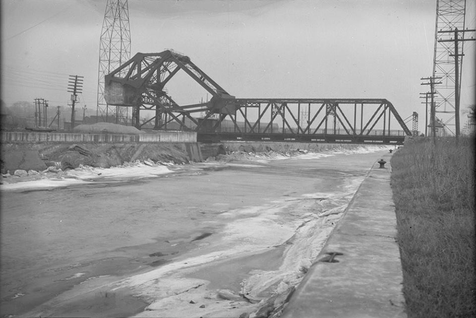
Grand Trunk elevators, Lachine Canal, ca. 1918. (Source: City of Vancouver Archives)
Historic Significance: The Lachine Canal played a major economic role in linking the Port of Montreal to Upper Canada and the West through the St. Lawrence River and the Great Lakes. The Dominion Bridge Company, located on the north side of west end of the canal, used it to ship fabricated steel to major bridge projects including the Quebec Jacques Cartier Bridges.
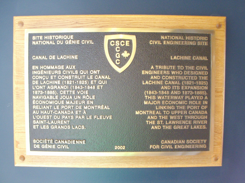
Plaque Wording: Site Historique National du Génie Civil. SCGC. CANAL DE LACHINE. En hommage aux ingénieurs civils qui ont conçu et construit le canal de Lachine (1821-1825) et qui l’ont agrandi (1843-1848 et 1873-1885). Cette voie navigable joua un rôle économique majeure en reliant le port de Montréal au Haut-Canada et à l’ouest du pays par le fleuve Saint-Laurent et les Grands Lacs. Société canadienne de génie civil. 2002.
CSCE. National Historic Civil Engineering Site. LACHINE CANAL. A tribute to the civil engineers who designed and constructed the Lachine Canal (1821-1825) and its expansion (1843-1848 and 1873-1885). This waterway played a major economic role in linking the Port of Montreal to Upper Canada and the West through the St. Lawrence River and the Great Lakes. 2002. Canadian Society for Civil Engineering.
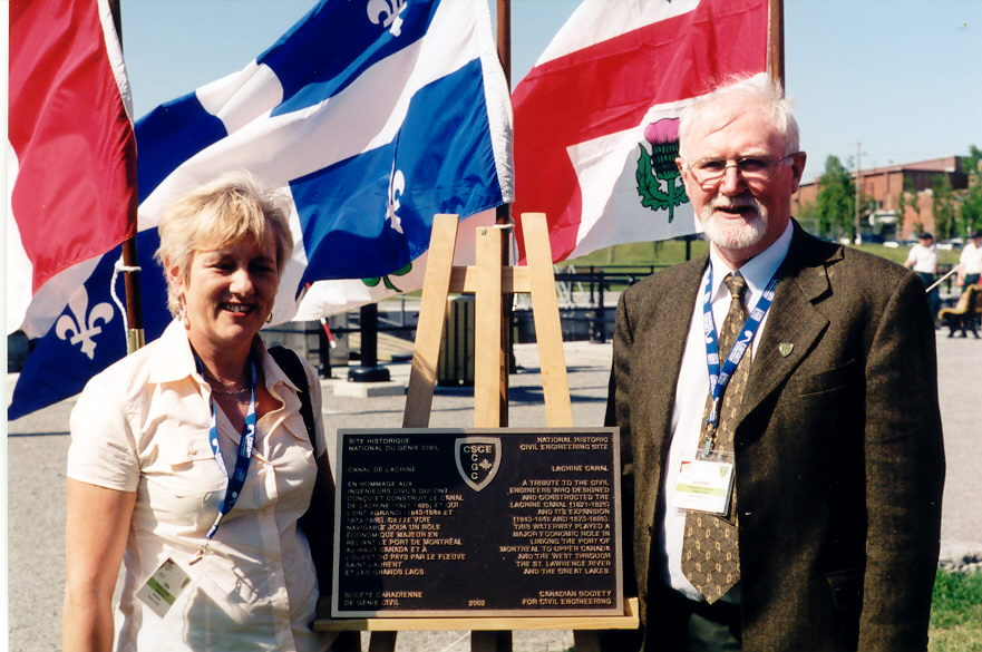
Plaque Unveiling Ceremony:
Links to Online Documentation: