Site Location: Lat.: 46° – 48’ – 28” N.; Long.: 71° – 12’ – 25” W. (GPS: 46.8077997, -71.2068986). From the Trans-Canada Highway 20, take Exit 312N to merge onto Autororoute 73N toward Québec/Pont Pierre-Laporte. Proceed for 4.5 km and take Exit 134-E for QC-175N/Boul Laurier toward Québec/Centre Ville. Proceed for 8.2 km and turn right (south east) on Cours du Général de Montcalm and, after 0.1 km, turn left (north east) onto Avenue Wilfred-Laurier. Proceed 0.35 km and turn left (north west) on Place George V E. After 0.1 km, turn right (north east) onto Grande Allée E/QC-175 N. Proceed 0.3 km, as the street turns into Rue Saint Denis, and turn right (south) onto Côte de la Citadelle and proceed 0.2 km to the Citadelle. Bus #11 stops in front of the National Assembly: from there walk 220 m north-east on Grande Allée/Rue Saint Denis and turn right (south) on Côte de la Citadelle.
Plaque Location: The plaque is mounted on a wall that is currently being reconstructed.

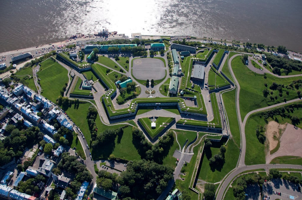
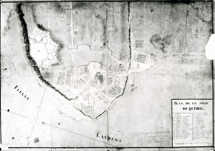
Description: The fortification walls of Québec are 4.6 km (2.9 mi) long. The initial military works included Fort Saint-Louis, built by Samuel de Champlain on the edge of the cliffs in 1620. After the fall of Louisbourg in 1745, the fortifications of Québec were improved, under the direction of engineer Gaspard-Joseph Chaussegros de Léry. After the conquest of New France in 1860, the British maintained the fortifications and, between 1778 and 1783 constructed a citadel on Cap Diamant. Further improvements and additions were made between 1786 and 1812, including construction of a Martello Tower. The present Québec Citadel was constructed between 1819 and 1832.

Historic Significance: France considered Québec to be an important part of the defense strategy between 1700 and 1720, but the considerable sums granted to the city yielded only an incomplete defence system. Funding ceased in 1721 and was used instead to fortify Montréal, given its eastern location and fur-trading wealth, and Louisbourg, given its abundant fishing banks. The treats of attacks by the French post 1760 and by the Americans post 1776 spurred British initiatives to improve the fortifications.
Gaspard-Joseph Chaussegros de Léry (1682-1756) was trained in military engineering, probably by his father. In 1716, he was dispatched to Canada to devise plans of fortifications to protect Québec from attack. He was subsequently appointed chief engineer and held this post until his death.
The historic fortifications are a major reason why Quebec City is a UNESCO World Heritage Site.

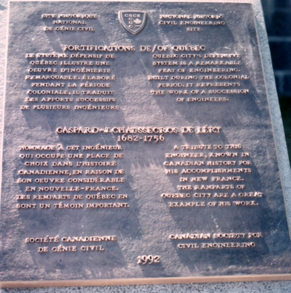
Plaque detail. (Source: CSCE)
Plaque Wording: SCGC. Site Historique National de Génie Civil. FORTIFICATIONS DE QUÉBEC. Le système défensif de Québec illustre un oeuvre d’ingénierie remarquable. Élaboré pendant la période colonial, il traduit les apports successifs de plusieurs ingénieurs. GASPARD – J. CHAUSSEGROSE DE LÉRY. 1682-1756. Hommage à cet ingénieur qui occupe une place do choix dans l’histoire canadienne, en raison de son oeuvre considerable en Nouvelle-france. Les remparts de Québec en sont un témoin important. Société canadienne de genie civil. 1992.
CSCE. National Historic Civil Engineering Site. FORTIFICATIONS OF QUÉBEC. Quebec City’s defensive system is a remarkablefeat of engineering. Built during the Colonial period, it represents the work of a succession of engineers. GASPARD – J. CHAUSSEGROSE DE LÉRY. 1682-1756. A tribute to this engineer, known in Canadian history for his accomplishments in New France. The Ramparts of Quebec City are a great example of his work. Canadian Society for Civil Engineering. 1992.
Links to Online Documentation:
Parks Canada, “Fortifications of Québec National Historic Site”.
Canada’s Historic Places, “Fortifications of Québec National Historic Site of Canada”.