Chambly Canal, Chambly, QC.
Site Location: Lat.: 45° – 26’ – 50” N.; Long.: 73° – 16’ – 59” W. (GPS: 45.4472595, -73.2830791). On the north-east end of the bridge on Avenue Bourgogne in Chambly, QC. From the Trans-Canada Highway 20, take Exit 112 toward QC-223/ Rue Richelieu/Sainte-Marc-sur-Richelieu/Beloeil. After 0.35 km, turn left (east) onto Rue Serge-Pepin (signs for QC-223) and, after 800 m, turn right (south) onto Rue Richelieu/QC-223 S (signs for Beloeil). Proceed for 18.1 km and turn left (east) onto Boulevard de Péringy E/QC-112 E/QC-223S (signs for Chambly). Proceed 1.7 km, turn left (east) onto Avenue de Salaberry, proceed 0.25 km and, at the roundabout, take the first exit onto Avenue Bourgogne. Proceed 0.65 km to the site on the left (north).
Plaque Location: The plaque is mounted on the east side of Lock No. 1 of the Chambly Canal.
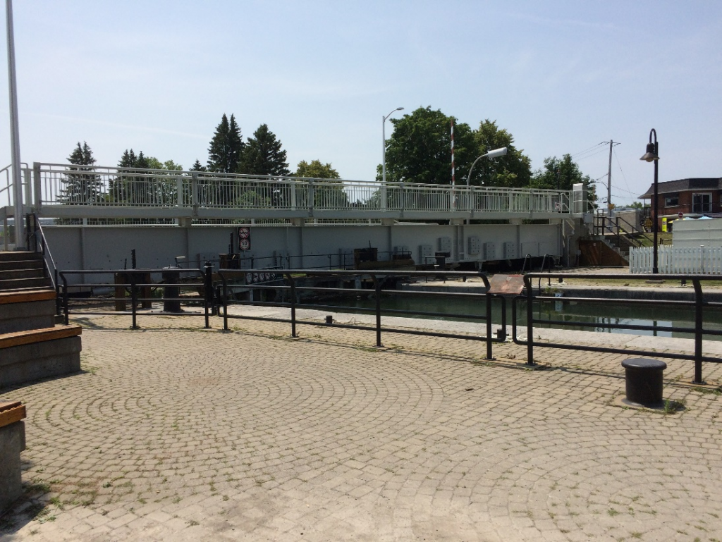
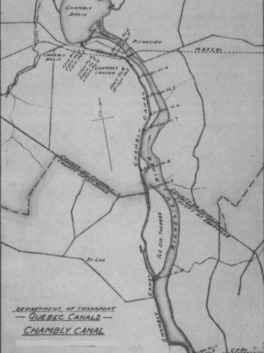
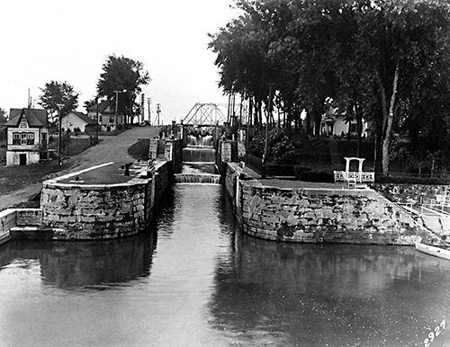
Description: The Chambly Canal is a 20 km (12.5 mi.) navigable waterway constructed between 1833 and 1841 that connects Saint-Jean-sur-Richelieu and Chambly. It was originally constructed to bypass the Chambly Rapids on the Richelieu River. The canal consists of nine locks five weirs, two piers, dams, dikes and bridges. The initial construction was by a company led by three Americans and the Andres brothers of Chambly, which went bankrupt in 1834. The subsequent canal, constructed between 1840 and 1843, was designed by William R. Hopkins. It was altered in 1848-60, 1869-1880, and 1880-1895, and restored by Parks Canada for recreational use in 1977-1980 and 1990.
Historic Significance: The Richelieu River was originally known as the River of the Iroquois, who used it as a war route to attack Algonquin tribes residing in the St. Lawrence River Valley. In 1603 Samuel de Champlain ascended the river as far as the rapids of Saint-Ours, and in 1609 he used it to travel to Lake Champlain.
The canal was built as part of the navigable waterway, including Lake Champlain and the Champlain Canal in the United States, to connect Montreal and New York City. From 1835 until the 1960s, it was used to ship various Canadian wood products to the United States, and to bring coal from Pennsylvania to Canada. Since the 1970s it has primarily been used by recreational traffic.
William R. Hopkins was appointed Engineer of the Pennsylvania Canal in 1828, before his work on the Chambly Canal.
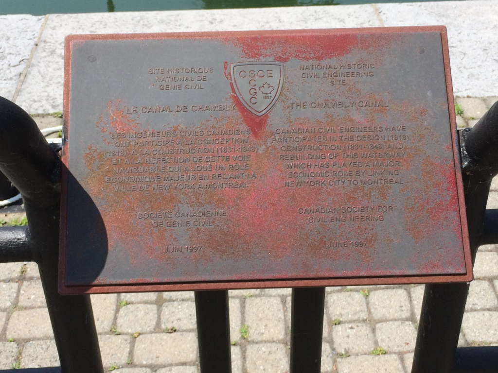
Plaque Wording: Site Historique National de Génie Civil. SCGC. LE CANAL DE CHAMBLY. Les ingénieurs civils canadiens on participé à la conception (1818), à la construction (1831-1843) et à la reflection de cette voie naviguable qui a joué un role économique majeur en reliant la ville de New York à Montréal. Société canadienne de genie civil. Juin 1997.
CSCE. National Historic Civil Engineering Site. THE CHAMBLY CANAL. Canadian civil engineers have participated in the design (1818), construction (1831-1843) and rebuilding of this waterway which has played a major economic role by linking New York City to Montreal. Canadian Society for Civil Engineering. June 1997.
Links to Online Documentation:
Parks Canada, “Chambly Canal National Historic Site”
Canada’s Historic Places, “Chambly Canal National Historic Site of Canada”