This Historic Project is commemorated jointly by CSCE, ASCE (American Society of Civil Engineers) and the AIC (Asociación de Ingenieros de Caminos, Canales y Puertos de España – Spanish Civil Engineering Association)
Site Location: West Coast of North America.
Plaque Location: In storage at the Vancouver Maritime Museum, 1905 Ogden Ave, Vancouver, BC. Lat.: 49° – 16’ – 39” N; Long.: 123° – 8’ – 50” W. (GPS: 49.277517, -123.147183). From Trans-Canada Highway 1, take Exit 27, East 1st Avenue. Travel 5.5 km west, as East 1st Avenue turns into Terminal Avenue, and turn left (south) on Quebec Street. After 0.5 km, turn right (west) on East 2nd Avenue, and continue west for 2.4 km as East 2nd Ave. becomes West 6th Ave. Bend right to enter West 4th Ave and, after 0.9 km, turn right (north) on Burrard Street. After 0.5 km, turn left (west) on Cornwall Avenue and, after 0.2 km, turn right (north) on Cypress Avenue. Continue straight through one roundabout 0.4 km, and, at the second roundabout, take the first exit east onto McNicholl Avenue. After 0.1 km, turn left (north) on Chestnut Street – the Vancouver Marine Museum is 0.2 km away on the left.
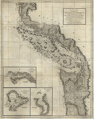
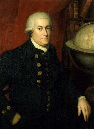
Description: Captain George Vancouver left England with the HMS Discovery and the HMS Chatham in 1791, tasked with exploring the Pacific region. In the first year, the expedition collected botanica samples and surveyed coastlines at Cape Town, Australia, New Zealand, Tahiti and Hawaii. He then sailed east to North America and followed the coasts of present-day Oregon and Washington northward. He entered the Strait of Juan de Fuca on 29 April 1792 and from there surveyed the west coast of the mainland to Alaska. Returning south that June, he met a Spanish expedition led by Dionisio Alcalá Galiano and Cayetano Valdés y Flores who showed him their crude chart of the Strait of Georgia made by José María Narváez a year earlier.

Historic Significance: Vancouver’s voyage, 1791 -1795, resulted in the most accurate and detailed map of its time for the entire west coast of North America, and proved conclusively the absence of a Northwest Passage through the continent. Vancouver was the first European to discover and map Puget Sound and to prove the insularity of Vancouver Island. His survey of coastal British Columbia and southern Alaska benefited from information received from contemporary Spanish explorers. Vancouver’s charts, used by mariners late into the 19th century, and those of the Spaniards served as important references during settlement of the international boundary disputes between Great Britain and the United States in 1846 and 1872.
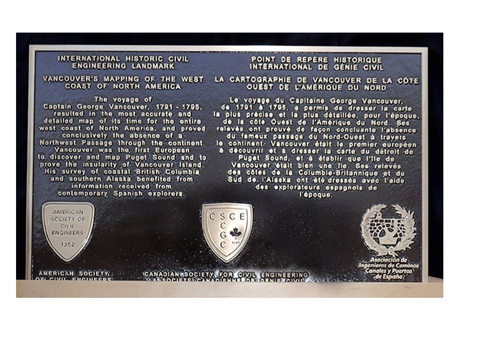
Plaque Wording: International Historic Civil Engineering Landmark. VANCOUVER’S MAPPING OF THE WEST COAST OF NORTH AMERICA. The voyage of Captain George Vancouver, 1791-1795, resulted in the most accurate and detailed map of its time for the entire west coast of North America, and proved conclusively the absence of a Nortwest Passage through the continent. Vancouver was the first European to discover and map Puget Sound and to prove the insularity of Vancouver Island. His survey of coastal British Columbia and southern Alaska benefited from information received from contemporary Spanish explorers. American Society of Civil Engineers. Canadian Society for Civil Engineering. Asociación de Ingenieros de Caminos, Canales y Puertos de España.
Point de Repére Historique International de Génie Civil. LA CARTOGRAPHIE DE VANCOUVER DE LA CÔTE OUEST DE L’AMÉRIQUE DU NORD. Le voyage du Capitaine George Vancouver, de 1791 à 1795, a pemis de dresser la carte la plus precise et la plus détaillée, pour l’époque, de la côte Ouest de l’Amérique du Nord. Ses relevés ont prove de façon concluante l’absence du fameux passage du Nord-Ouest à travers le continent. Vancouver était le premier européen à découvrir et à dresser la carte du détroit de Puget Sound, et à etablir que l’île de Vancouver était bien une île. Ses relevés des côtes de la Columbie-Britannique et du Sud de l’Alaska ont été dresses avec l’aide des explorateurs espagnols de l’époque. American Society of Civil Engineers. La société canadienne de genie civil. Asociación de Ingenieros de Caminos, Canales y Puertos de España.
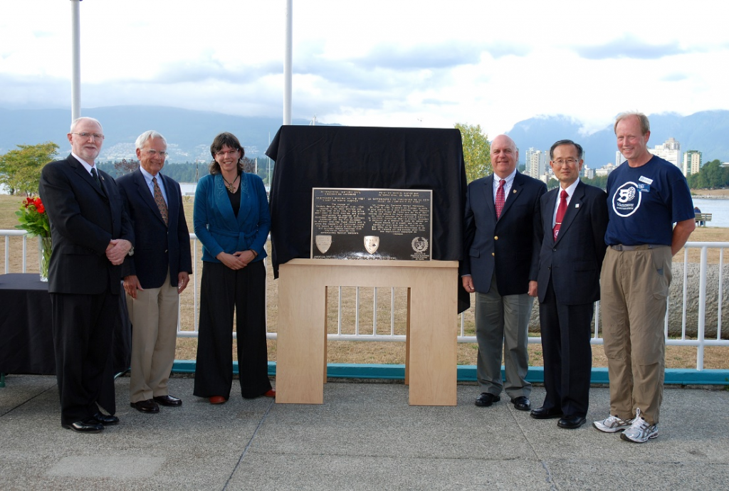
Plaque Unveiling Ceremony: (5:00 pm, Sunday August 9, 2009)
Link to Online Documentation:
Junius Rochester, Vancouver, George (1758-1798), HistoryLink.org, 2003.