Site Location: Lat.: 42° – 52’ – 43” N; Long.: 79° – 35’ – 12” W. (GPS: 42.8786216, -79.5866427) Dunnville is on Ontario Highway 3 approximately 40 km south of Hamilton. From Highway 3, in downtown Dunnville, take Chestnut Street south for 130 m. and turn right (west) on Queen Street. Continue on Queen for 1.2 km as it bends, becomes Rainham Road, and crosses the Grand River. Turn left (southeast) on Port Maitland Road and follow it for 3.7 km to the entrance to the No. 6 RCAF Museum, on your right.
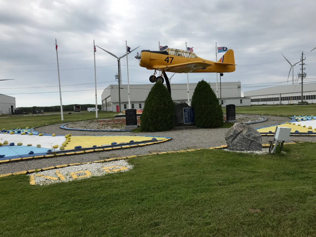
Plaque Location: The plaque is situated within a Memorial Garden located about 50 m west of the museum building. The garden features a Harvard aircraft with the RCAF flag and the flags of those of the five countries whose flyers were trained there. There are also a number of memorial plaques commemorating those who died in training accidents.

Description: In December 1939, Great Britain, Canada, Australia and New Zealand reached an agreement to train 1500 aircrew per month, starting in April 1940. The total estimated cost was $600 M and the estimated Canadian contribution, $350 M, was considerable given the total federal budget for 1939 was $500 M. The training rate peaked at over 3000 graduates per month. The total cost of $ 1.76 billion included a Canadian contribution of $1.59 billon.
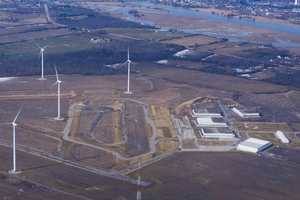
The No. 6 Service Flying Training School (SFTS) was located near Dunnville from November 1940 to December 1944. Pilots were trained to fly single-engine Yale, Harvard and Anson aircraft at 6SFTS. The field featured six 30 m. wide hard-surfaced runways with lengths that varied from 730 to 1100 m. Flight operations ceased in May 2013 to make way for industrial wind turbines.

Historic Significance: The challenges for Canadian civil engineers working on the project included site selection and then the design and construction of runways, taxiways, roads, services, hangers, barracks and many other buildings to a very demanding schedule. The key to success was the development of standard airfield layouts and standard building designs using prefabricated wood components. In 1945, Winston Churchill described the BCAPT as “a spacious task imaginatively conceived and most faithfully carried out.” The initiative provided the foundation of Canada’s post-war air transportation network: of the 176 airfields constructed, 62 remain in service today including the Toronto and Vancouver International Airports.

Plaque Wording: National Historic Civil Engineering. CSCE. BRITISH COMMONWEALTH AIR TRAINING PLAN No. 6 SERVICE FLYING TRAINING SCHOOL - DUNNVILLE. A tribute to Canada’s civil engineers who, between 1940 and 1943, were responsible for the design and construction of 88 airfields and 88 reilef fields, together with all the requisite infrastructure. The airfields were required by the British Commonwealth Air Training Plan which trained more than 250,000 personnel, of whom 131,000 were aircrew, for the Allied war effort. This field, Dunnville Airport, was the site of No. 6 Service Flying School. Canadian Society for Civil Engineering. 2003.
SCGC. Site Historique National. CSCE. BRITISH COMMONWEALTH AIR TRAINING PLAN No. 6 SERVICE FLYING TRAINING SCHOOL – DUNNVILLE. Hommage aux ingénieures civiles du Canada, qui entre les années 1940 et 1943, étaient résponsables pour la conception et l’étabilssement de 88 terrains d’aviations et de 88 terrains supplémentaires, ainsi que toute l’infrastructure requise. Les terrains d’aviation étaient requis par le British Commonwealth Air Training Plan, qui a entrainé au-delà de 250,000 personnels, dèsquels 131,000 fassaient partie du pilotage pour l’appui allié de la guerre. Ce terrain, l’aéroport municipal d’Oshawa, était le site de l’école de vol de base, No. 6 Service Flying School. 2003. Société canadienne de genie civil.
Links to Online Documentation:
Alistair MacKenzie, “History: A Herculean Task”, Canadian Consulting Engineer, 2001.
Veterans Affairs Canada, “The British Commonwealth Air Training Plan”