This International Civil Engineering Landmark is commemorated jointly by CSCE and the ASCE (American Society of Civil Engineers).

Since 1848, a system of bridges has been built across the Niagara River to connect Canada with the United States. Those that stand today include the Peace Bridge (steel arch), the International Railway Bridge (iron truss), the Rainbow Bridge (steel arch), the Railway Steel Arch Bridge, Whirlpool Bridge (spandrel-braced arch), and the Queenston-Lewiston Bridge (steel arch).
Plaque Location: Lat.: 43° – 5’ – 21” N.; Long. 79° – 3’ – 57” W. (GPS: 43.089061, - 79.065725). Cross Rainbow International Bridge to Niagara Falls, NY, bending left to continue east on Niagara Street. After 0.2 km, turn left (north) onto 1st Street, which becomes Robert Moses Parkway. Proceed 0.5 km and turn left into the Niagara Gorge Discovery Center and park in the parking lot. From the southwest corner of the parking lot, walk south (along the rim of the Niagara River gorge) on the pathway about 430 m, almost to the Rainbow Arch Bridge. The landmark plaque will be on your right.


Plaque wording: International Historic Civil Engineering Landmark. BRIDGES OF NIAGARA. Since 1848 many bridges have spanned the Niagara Gorge below Niagara Falls. The design and construction of these bridges was necessary for the economic development of the Niagara Falls area. The demand for safe and convenient crossings was easily apparent. This need provided a great challenge to civil engineers and to the development of bridge engineering technology. The successful crossing of the gorge required the skill of many engineers willing to take risks and extend their engineering knowledge beyond established limits. Their foresight and intuition contributed to the refinement and advancement of design techniques for suspension and arch bridges. Niagara Suspension Bridge – 1848; Lewiston & Queenston Suspension Bridge – 1851; Niagara Railway Suspension Bridge – 1855; Niagara Falls & Clifton Suspension Bridge – 1869; Niagara Cantilever Railway Bridge – 1883; Niagara Railway (Whirlpool Rapids) Arch Bridge – 1897 *; Falls View (Honeymoon) Arch Bridge – 1898; Lewiston & Queenston Suspension Bridge – 1899; Michigan Central Arch Bridge – 1925 *; Rainbow Arch Bridge – 1941 *; Lewiston-Queenston Arch Bridge – 1962 *. * Currently in use. Presented by the American Society of Civil Engineers and the Canadian Society for Civil Engineering. ASCE designated 1992. CSCE dedicated 2005.
Peace Bridge, Fort Erie, ON. to Buffalo, NY.

Location: Lat.: 42° – 54’ – 25” N; Long.: 78° – 54’ – 20” W. (GPS: 42.90694, -78.90556). The bridge is located at the end of the Queen Elizabeth Way at Fort Erie.
Description: The Peace Bridge, opened in 1927, carries highway traffic over the Niagara River between Fort Erie, Ontario and Buffalo, New York. The total bridge length is 1.77 km (5,800 ft.) comprising five steel deck arch spans ranging from 105 to 129 m (346 to 423 ft.) and a Parker through truss with a span of 110m (360 ft.) over the Black Rock Canal. Edward P. Lupfer of Buffalo carried out the design, assisted by consulting engineers William Russell Davis and John F. Stevens. The contractors were R. B. Porter of St. Catherines, ON, Turner Construction of Buffalo (substructure), and the Bethlehem Steel Company of Bethlehem, PA (steel superstructure). The bridge is illuminated with decorative floodlights at night. Plans for various replacement alternatives were shelved in 2012.
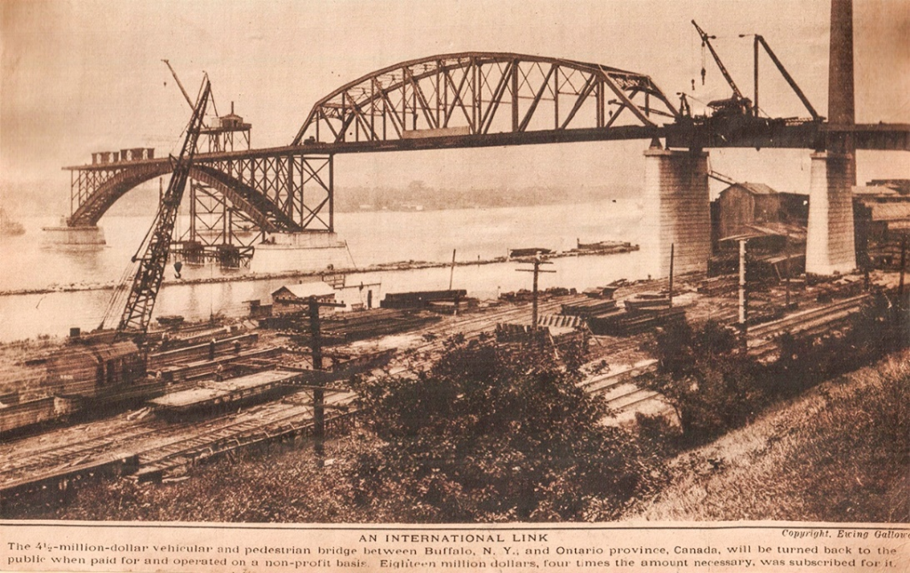
Historic Significance: The Peace Bridge was named to commemorate a century of peace between the United States and Canada. Construction was hindered by the strong river current, which averages 12 to 19 kmh (8 to 12 mph). In 1977, to celebrate the 50th anniversary of the bridge, both Canada and the United States issued commemorative Peace Bridge postage stamps.
Links to Online Documentation:
Bruce Jackson, “Beauty and the Bridge”, Intersight, 2001.
“Peace Bridge Dedication, August 7, 1927”, Buffalo History Gazette, 2015.
International Railway Bridge, Fort Erie, ON. to Buffalo, NY.
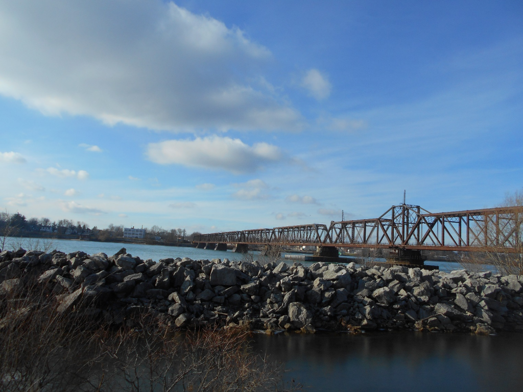
Location: Lat.: 42° – 54’ – 43” N.; Long.: 78° – 54’ – 48” W. (GPS: 42.928506, -78.913390). Eastbound on the Queen Elizabeth Way, take Exit 7, Bowen Road, toward County Rd 21. After 0.4 km, turn left (east) on Bowen Road. Proceed for 3.6 km, turn left (north) on Thompson Road and then, after 0.3 km, turn right onto Phipps St. Proceed for 2.1 km to the end of Phipps St. and turn right (south) on Niagara Blvd. Proceed 0.4 km: you will drive under the bridge.
Description: The International Railway Bridge carries the Canadian National Railway over the Niagara River. It has a total length of 600 m (1967.5 ft.) and comprises a main span of 109 m (358 ft.) and seven approach spans. The first railway bridge at this location was constructed for the American and Dominion International Bridge Companies by C.S. Gzowski & Co., and completed in 1873. Joseph Hobson was the resident engineer. The superstructure was replaced in 1901 by a series of Pratt trusses designed by Joseph Hobson and fabricated and erected by the Detroit Bridge and Iron Works. The swing span has not operated for many decades, but the bridge still carries typically 15 freight trains daily.
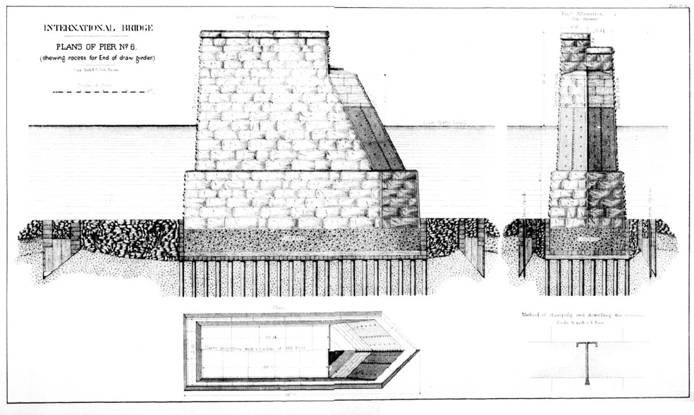
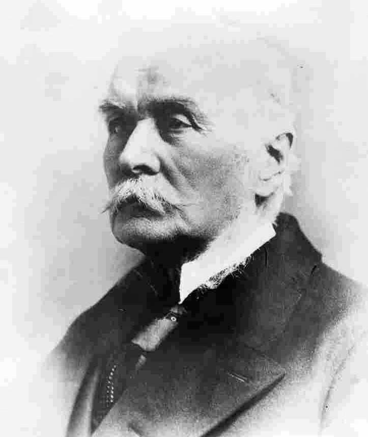
Historical Significance: The original construction was challenging because the Niagara River at the site is 14 m (45 ft.) deep with a velocity up to 19 kmh (12 mph). Large blocks of ice flow down the river during spring breakup, threatening the piers and bridge. The piers were placed using cofferdams, with many accidents. At the bridge opening in 1873, C. J. Brydges, General Manager of the Grand Trunk Railroad said “There is no other man in this country who could have carried on the work of this bridge or gone through the daily and hourly anxiety which it entailed during the past four years save Colonel Gzowski.” Gzowski was the President of the Canadian Society of Civil Engineers between 1889 and 1892, and the Gzowski Medal is the highest prize awarded by the CSCE. Joseph Hobson was Chief Engineer of the Grand Trunk Railway from 1882 until after 1907, and teamed up again with the Detroit Bridge and Iron Works to replace the Victoria Bridge superstructure in 1898.
Links to Online Documentation:
Biography of Sir Casimir Gzowski
Casimir Gzowski, “Description of the International Bridge Constructed over the Niagara River”, 1873.
“The International Bridge, Buffalo”, The Engineering Record, 1901.
Rainbow International Bridge, Niagara Falls, ON. to Niagara Falls, NY.
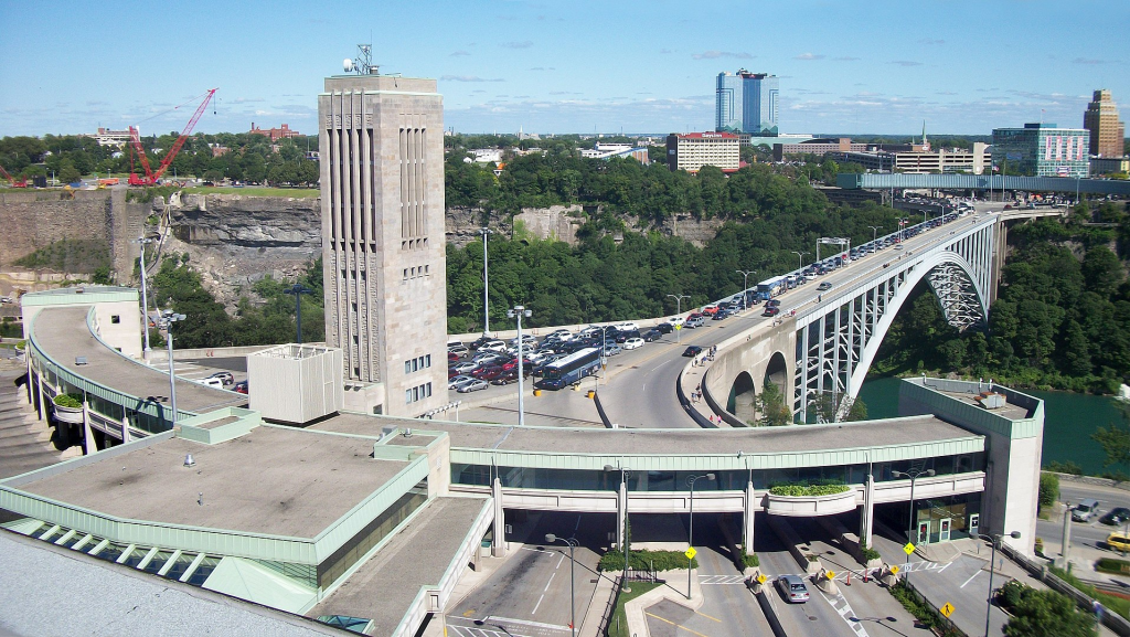
Location: Lat.: 43° – 5’ – 25” N.; Long.: 79° – 4’ – 4” W. (GPS: 43.0902131, -79.0676409). Eastbound on the Queen Elizabeth Way, take Highway ON-420 exit toward The Falls/Niagara Falls U.S.A. for 3.6 km, where it becomes Falls Avenue. Continue 1.6 km and find parking: the bridge approach is well marked.
Description: The Rainbow Bridge opened in 1941 to carry Roberts Street and Niagara Street between Niagara Falls, Ontario and Niagara Falls. New York. It replaced the Upper Steel Arch Bridge, designed by Leffert L. Buck and constructed in 1897-98 by the Pencoyd Bridge Company of Philadelphia under the direction of Engineer R. S. Buck. Also known as the Honeymoon Bridge, it collapsed on January 27, 1938 due to an ice jam in the Niagara River. The total length of the Rainbow Bridge is 440 m (1444 ft.) with the main span, a hingeless steel arch, 290 m. (950 ft.) long. It was designed by the New York firm of Waddell & Hardesty, and the structural steel was fabricated and erected by the Bethlehem Steel Company of Bethlehem, PA.
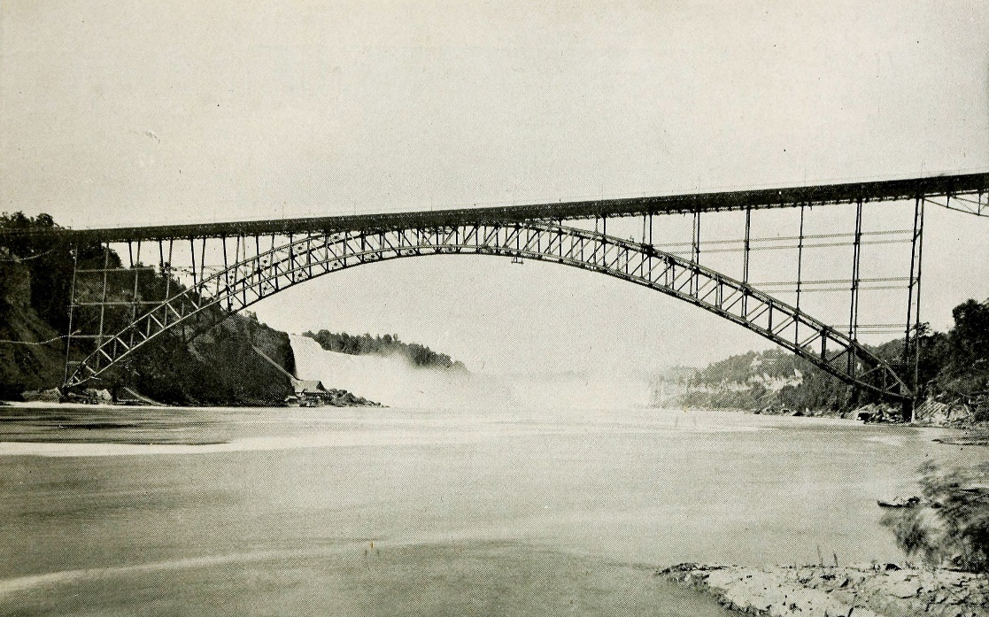
Historic Significance: There have been many significant bridges constructed at this site. The first was the Falls View suspension bridge, with a main span of 386 m (1268 ft.) that was the longest span in the world when it opened in 1869. It was constructed by Samuel Keefer (1811-1890), who served as the second President of CSCE, after his brother Thomas C Keefer. It collapsed, some say vanished, during a severe wind storm on January 10, 1889, perhaps because it had been widened the previous year without Keefer’s input. It was immediately rebuilt but quickly became functionally obsolete. The Honeymoon Bridge was the longest arch in the world when it opened. The Rainbow Bridge, also among the longest when it opened, received the American Institute of Steel Construction “Most Beautiful Bridge” award. J. A. L. Waddell was a very eminent American bridge engineer and the firm Waddell & Hardesty is now Hardesty & Hanover.
Links to Online Documentation:
Michigan Central Railway Bridge, Niagara Falls, ON. to Niagara Falls, NY.
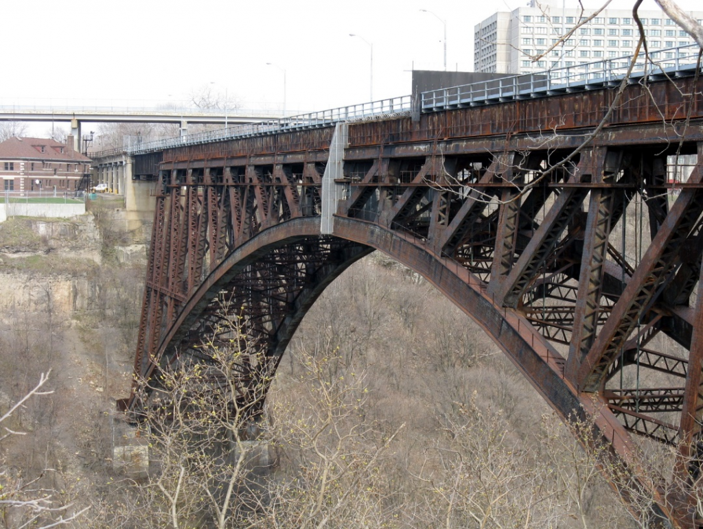
Location: Lat.: 43° – 6’ – 30” N.; Long.: 79° – 3’ – 35” W. (GPS: 43.108221, -79.059666). Eastbound on the Queen Elizabeth Way toward Niagara, take General Brock Pkwy/ON-405, follow signs for Queenston Lewiston U.S.A. After 5.1 km, take the Stanley Avenue/Regional Road 102 exit towards Niagara Falls/Niagara on the Lake. Turn right (south) on Stanley Avenue/RR 102. Proceed 1.4 km and turn left onto Whirlpool Road. Proceed 1.4 km and turn right (south west) onto Niagara Parkway/River Road. Proceed 2.6 km to the bridge, on the left (east)
Description: The first railway bridge constructed on this alignment was a steel cantilever truss with a total length of 276 m (906 ft.) and a clear main span of 145 m (476 ft.). Officially opened on December 1, 1883, it served the Michigan Central and Canada Southern Railways. It was designed by Charles C. Schneider and was fabricated and erected by the Central Bridge Works Company of Buffalo, NY. It was replaced in 1925 by the current structure, a steel arch designed by William Perry Taylor, Chief Engineer J. L. Delming and Norwegian-born consultant Olaf Hoff. The superstructure was fabricated and erected by the American Bridge Company of New York, NY. The arch span is 195 m (640 ft.) and the total length is 263 m (863.3 ft.). It served the New York Central, Penn Central, Conrail and Canadian Pacific Railways until 2001, when it was taken out of service.


Historic Significance: Schneider’s cantilever bridge and the similar Fraser River Bridge in British Columbia, while not the first cantilever bridges constructed, attracted the attention of Canadian and American engineers and so were prototypes for subsequent longer cantilever structures including the Quebec Bridge. The 1925 structure has not been significantly altered and is an excellent example of a large steel arch bridge.
Links to Online Documentation:
“The Michigan Central Railway Cantilever Bridge”
“New Niagara Gorge Arch Nearing Completion”, Railway Age, 1924
Whirlpool Rapids Bridge: Niagara Falls, ON. to Niagara Falls, NY.
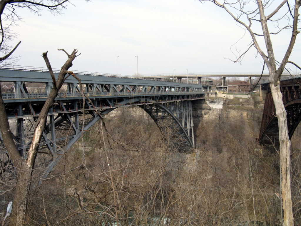
Location: Lat.: 43° – 6’ – 30” N.; Long.: 79° – 3’ – 34” W. (GPS: 43.1084441, -79.0595325). Eastbound on the Queen Elizabeth Way toward Niagara, take General Brock Pkwy/ON-405, follow signs for Queenston Lewiston U.S.A. After 5.1 km, take the Stanley Avenue/Regional Road 102 exit towards Niagara Falls/Niagara on the Lake. Turn right (south) on Stanley Avenue/RR 102. Proceed 1.4 km and turn left onto Whirlpool Road. Proceed 1.4 km and turn right (south west) onto Niagara Parkway/River Road. Proceed 2.5 km to the bridge, on the left (east).
Description: In 1846, the governments of Upper Canada and the State of New York permitted the formation of the Niagara Falls Suspension Bridge Company and the International Bridge Company of New York to jointly build and own the first bridge crossing of the Niagara River. They chose the site along the Niagara Gorge above the Whirlpool Rapids, which was the narrowest point from shore to shore. John A. Roebling designed the Railway Suspension Bridge, with a span of 251 m (825 ft.), which served the Great Western, New York Central and New York and Erie Railways between 1855 and 1897.

The Lower Arch Bridge, renamed the Whirlpool Rapids Bridge in 1939, was completed in 1897. It has a total length of 241 m (789.7 ft.) and a main span, a two-hinged spandrel-braced steel arch, of 168 m (550 ft.). Leffert L. Buck, who had been in charge of the maintenance of the Railroad Suspension Bridge, was the designer. The Pennsylvania Steel Company of Steelton, PA, fabricated and erected the superstructure. The bridge, with an upper deck for railway traffic and a lower deck for road traffic, remains in use today.
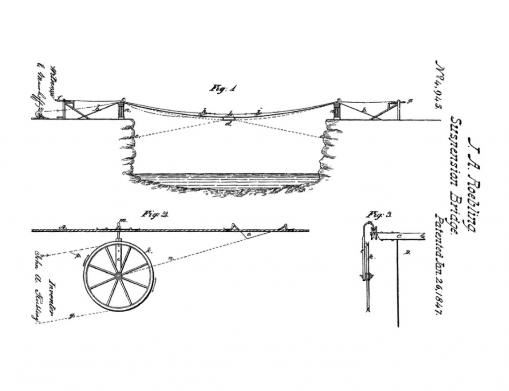
Historic Significance: The Niagara Suspension Bridge replaced a temporary suspension bridge designed by Charles Ellet, Jr., who initiated construction by offering $5 to the first boy to fly a kite across the gorge and secure the string to the other side. Roebling’s design was the first constructed using his patented cable-spinning technology, and used a system of stays above and below the deck to provide rigidity during strong winds. The double deck, with heavy side trusses, acted as a tube to provide torsional rigidity. The bridge required one-sixth the material of Stevenson’s Brittania Tubular Bridge, yet was twice as long and had a greater capacity. The three railways using the bridge had unique gauges, which were accommodated using to a clever system of four rails.
The Niagara Railroad Suspension Bridge was used by abolitionists running the Underground Railroad to get slaves to freedom in Canada. The bridge was also seen as a major tourist attraction, rivalling the Niagara Falls themselves.

The Lower Arch Bridge was constructed by the cantilever method around the railway suspension bridge, which remained open to road and rail traffic. It reflects the recognition that, as railway loadings increased, arch bridges became more cost-effective than suspension bridges for railway traffic. Leffert Buck (1837-1909) was a prominent bridge designer who retired as Chief Engineer of the Bridge Department of New York City in 1902.
Links to Online Documentation:
R. S. Buck, “The Niagara Railway Arch”, Transactions, ASCE, 1898.
“Charles Ellet, Jr.”, ASCE Biographies
“John Augustus Roebling”, ASCE Biographies
Lewiston-Queenston Bridge, Queenston, ON. to Lewiston, NY.
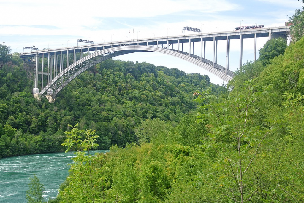
Location: Lat.: 43° – 9’ – 11’ N.; Long.: 79° – 2’ – 40’ W. (GPS: 43.1530524, -79.0443667). Eastbound on the Queen Elizabeth Way toward Niagara, take General Brock Pkwy/ON-405, follow signs for Queenston Lewiston U.S.A. General Brock Parkway takes you to and over the bridge.
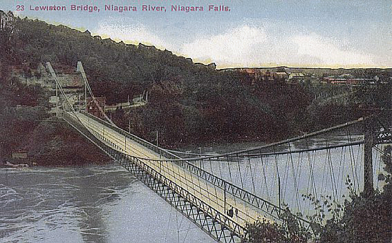
Description: There have been three crossings at this site. The first was a suspension bridge designed by Edward W. Serrell with a main span of 257 m (841 ft.) for horse and buggy and pedestrian traffic. It was constructed for the Queenston Suspension Bridge Company, with completion on March 20, 1851. It collapsed during a gale on February 3, 1854: guy wires connecting the bridge to the shoreline below had been disconnected to prevent damage from ice on the river. Ferry service across the river resumed.
The second crossing, also a suspension bridge, was designed by Leffert L. Buck and erected by the Pencoyd Bridge Company. Elements of the dismantled Falls View Suspension Bridge, previously erected at the site of the Rainbow International Bridge, were re-erected. The bridge officially opened on July 21 1899 and remained in service until November 2, 1962.
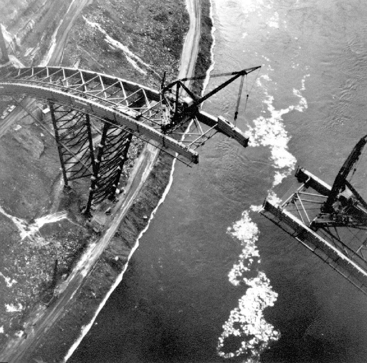
The current crossing, a steel deck arch with a main span of 305 m (1000 ft.) and a total length of 486 m (1594 ft.) opened on November 1, 1962. It was designed by Hardesty and Hanover, with the steel superstructure fabricated and erected by the Bethlehem Steel Company of Bethlehem, PA. It was erected using falsework from below to support the halves of the partially completed arch ribs.
Historic Significance: Edward Serrell also designed the Reversing Falls Road Bridge in Saint John, NB, in 1853. The Queenston-Lewiston arch is the highest bridge in Canada, at 113 m (370 ft.).
Links to Online Documentation: